DIGITAL Mapping
Empower Spatial Digitalization to make informed decisions.

Optimize your operations through informed decision making using precise and detailed maps.
Our digital mapping services are designed to transform your spatial insights with advanced technology and expert technique. Our Geographic Information System (GIS) Mapping services are designed to transform your spatial insights through advanced technology and expert techniques. We specialize in delivering precise, detailed geospatial mapping tailored to your unique requirements. Whether you need utility mapping for efficient resource allocation, LiDAR mapping to address modern challenges, or vectorization to extract features and maps, our expertise ensures exceptional results. Unlock the full potential of geographic mapping for your projects. Let us help you the power of GIS mapping to achieve your objectives with precision and confidence.
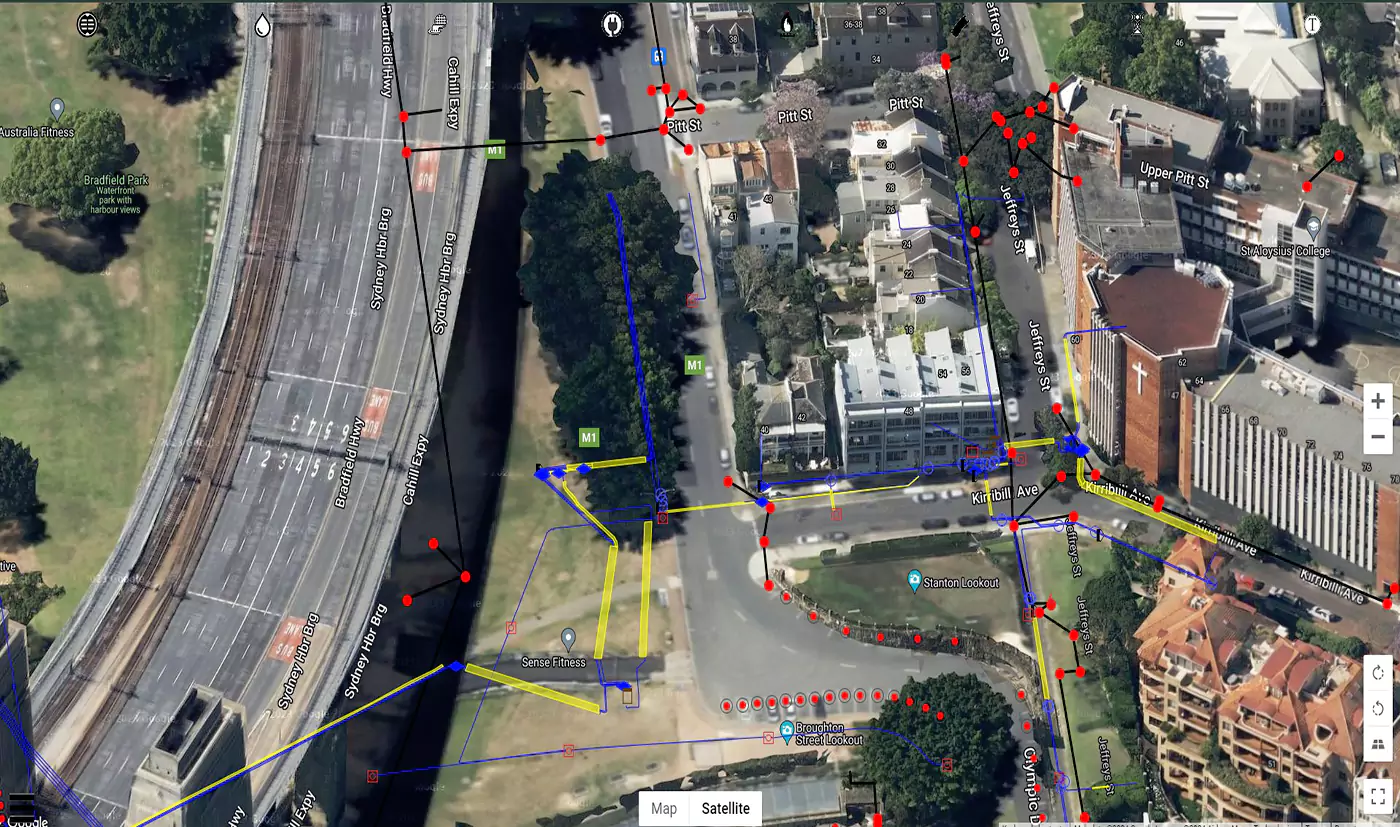
Convert utility data into detailed digital maps, enhancing project accuracy and ensuring reliable utility mapping.
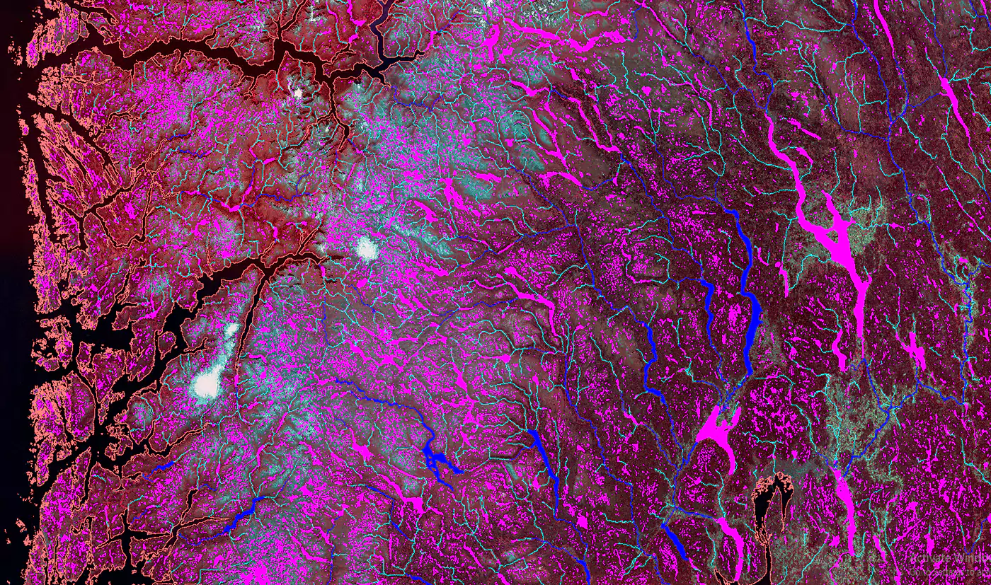
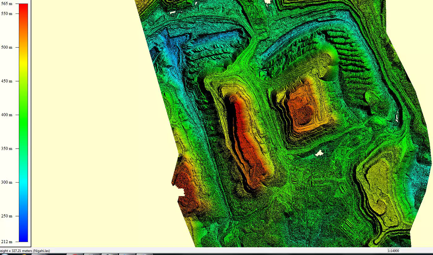
Empower your mapping projects with LiDAR technology. Dive into our range of LiDAR solutions designed for modern mapping challenges.
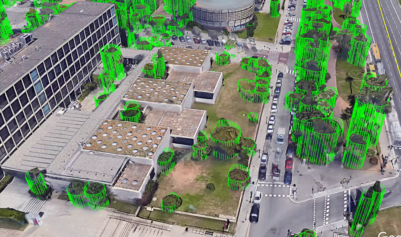
Understand and manage landscapes, facilitated by LULC Mapping.
Discover the potential of images as we extract features and maps for your exploration needs.
Transform images into precise 3D models with our photogrammetry service for detailed spatial insights.


CASE STUDIES

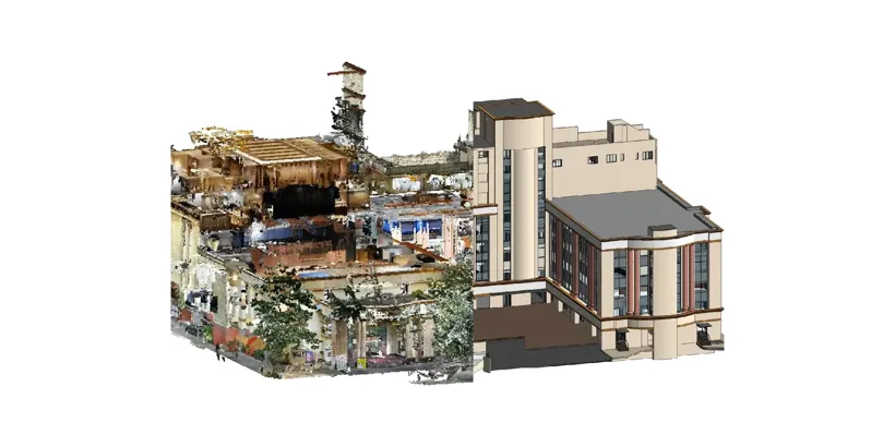
Scan to BIM
Commercial Building
This case study highlights our expertise in delivering highly accurate...

Scan to Bim
Commercial Building
This case study showcases our expertise in delivering precise and...

Scan to BIM
Historical Building
This case study highlights how our Scan to BIM services...
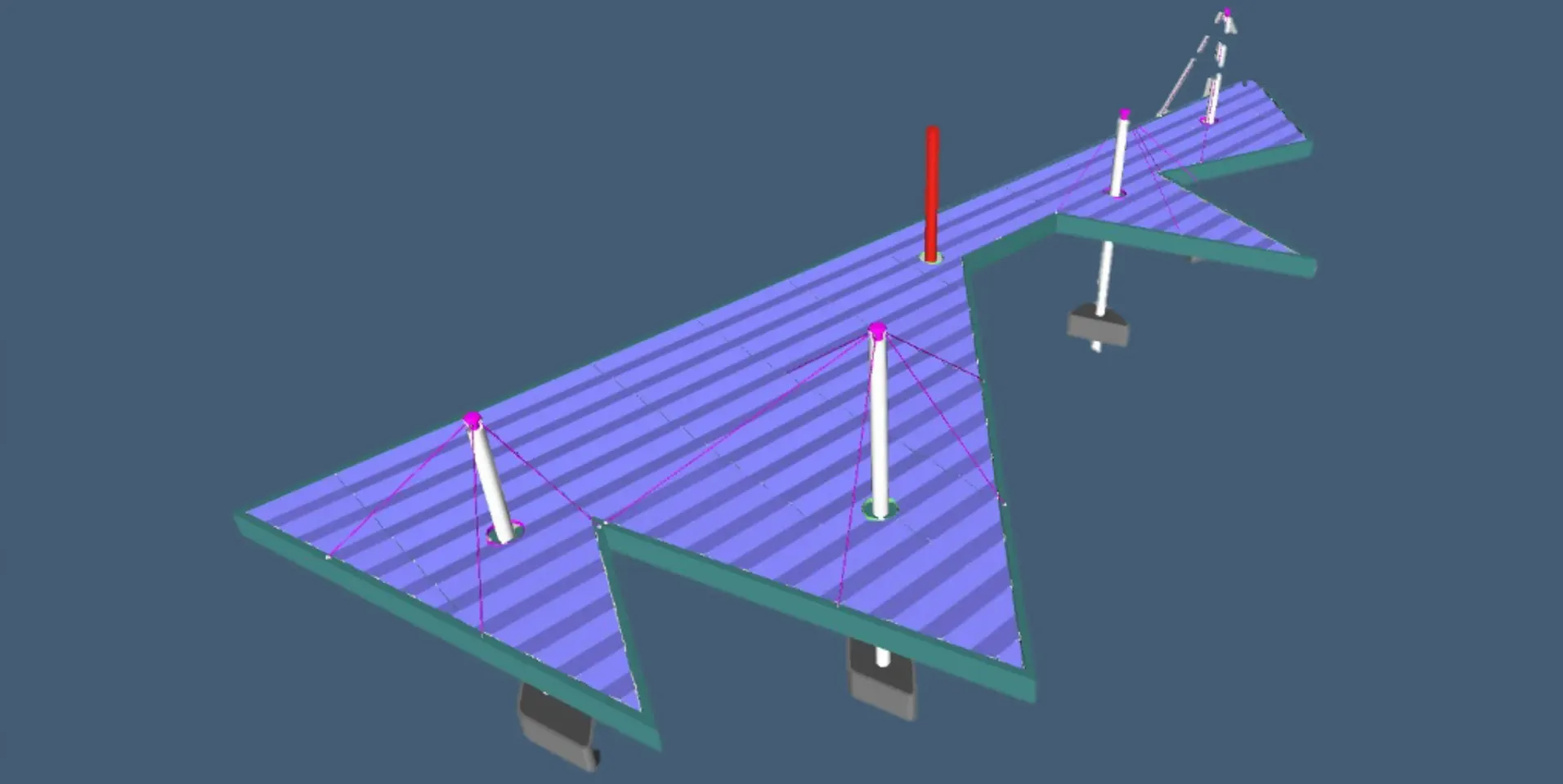
Digital Built
Natyakala mandir
This case study shows how our services accurately measure, visualize...
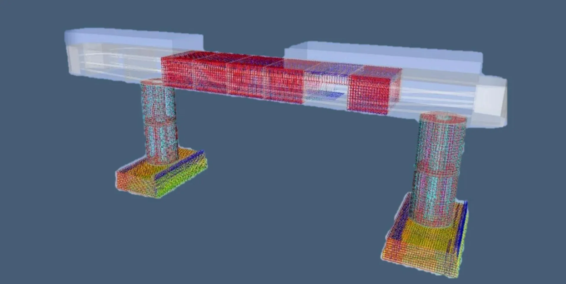
BIM Consultancy
Bar bending schedule (BBS)
Clove Technologies beat international competition to bag a series of...
PhotoGrammetry
Cutting-Edge Digitized GIS Custom Map Solutions
Clove Technologies isn't just mapping your world, they're creating a...
Architectural
Transforming Facades with BIM Expertise
Clove Technologies brings facades to life with BIM expertise! See...

APPLICATION DEVELOPMENT
Airstrip flyzone limitations
Developed an application to enable users to visualize restricted zones...
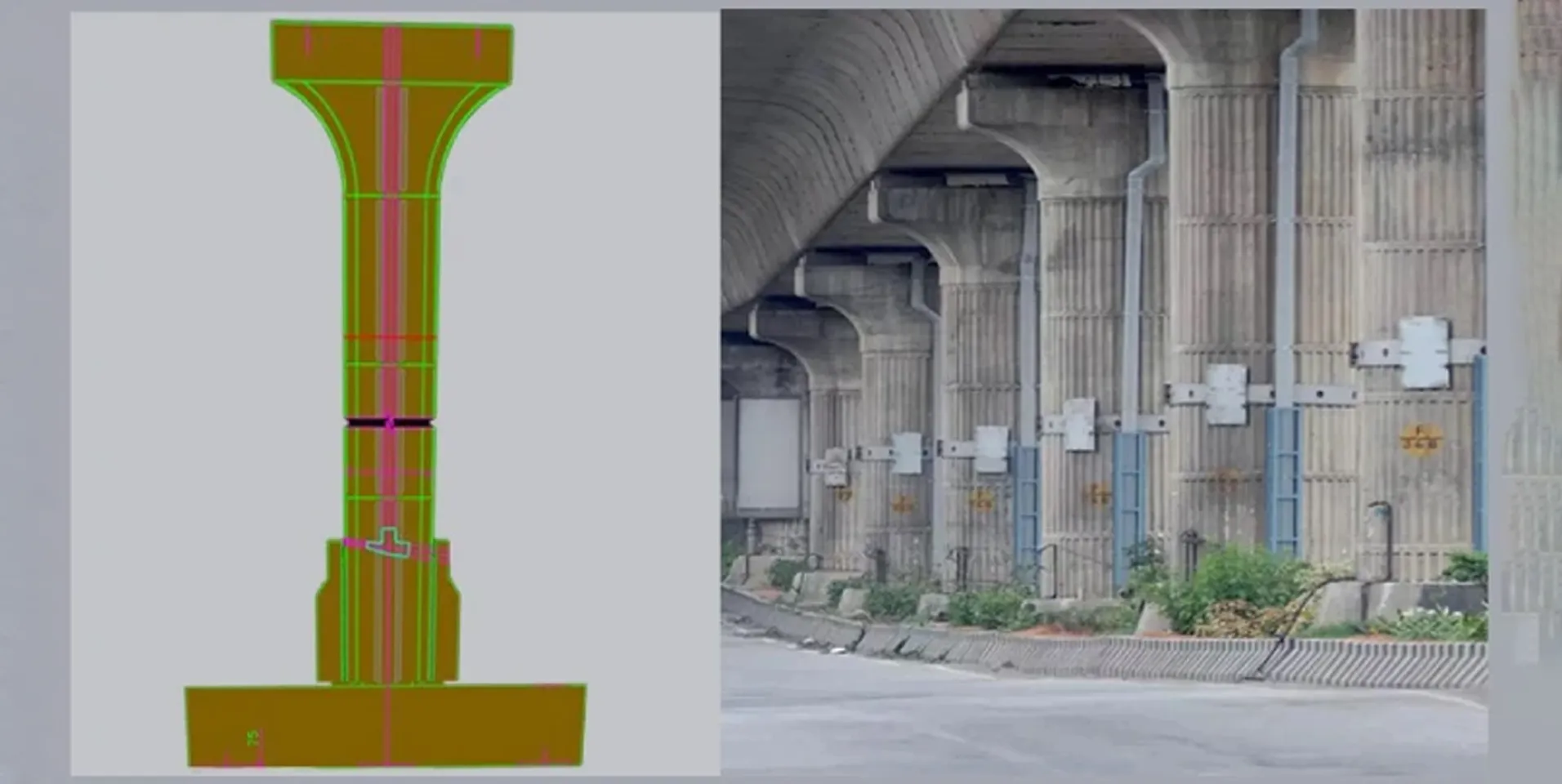
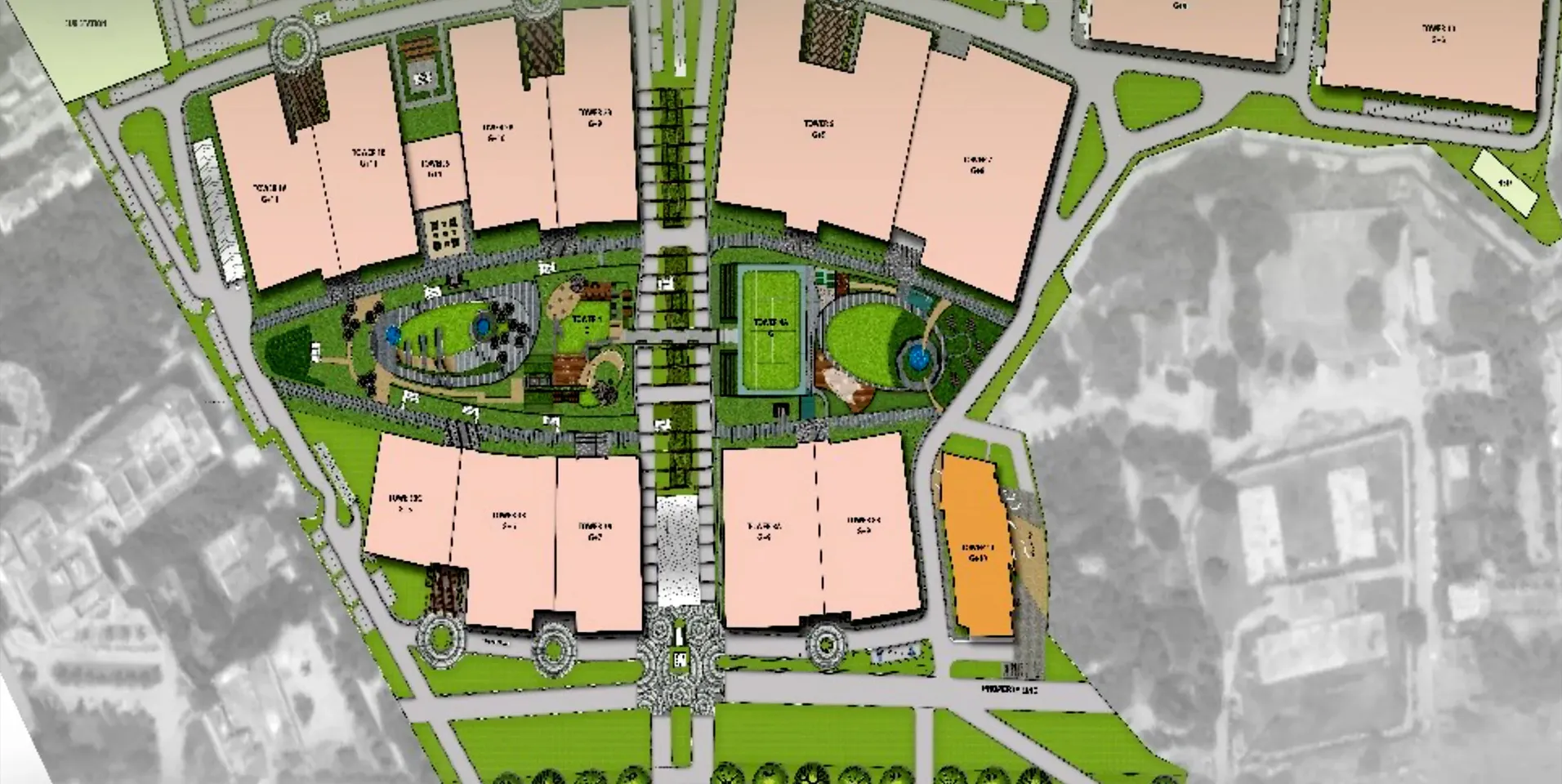
BIm Consultancy
Nagpur metro
This case study shows how our services enabled the creation...
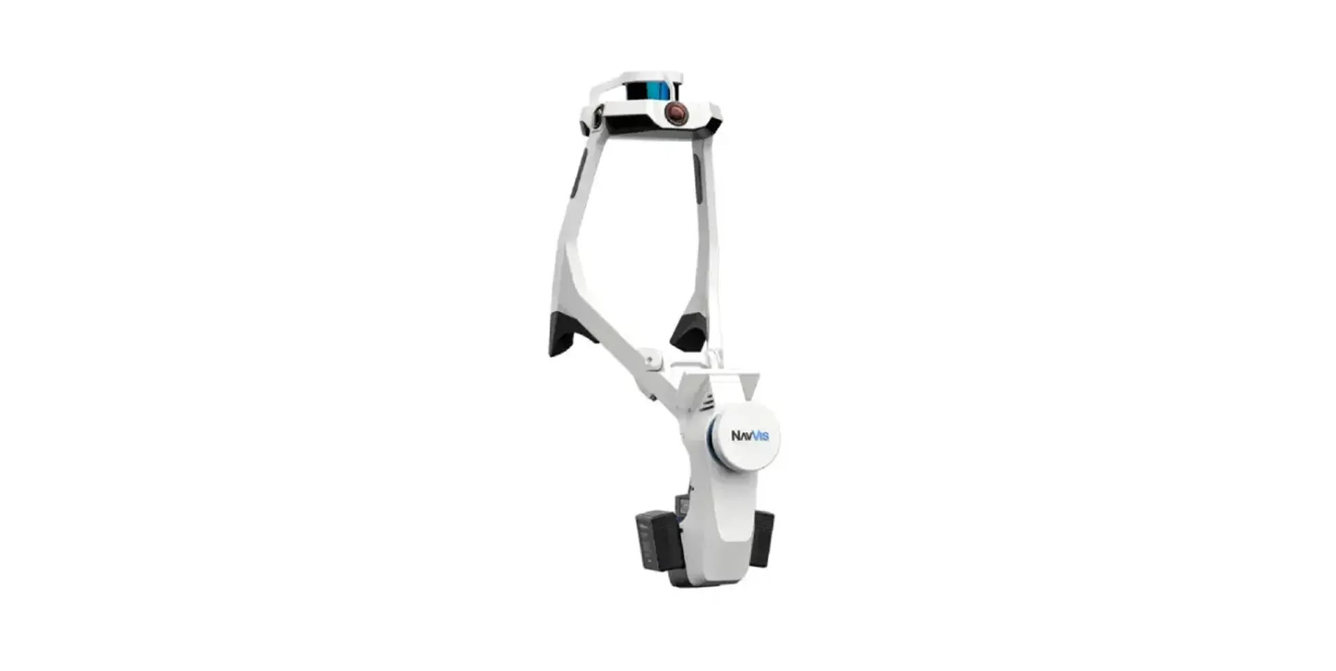
Owners
NavVis utilization
This case study explores the innovative application of laser scanning...
FAQ
Digital mapping involves creating precise and detailed maps using advanced techniques. These maps offer valuable spatial insights, aiding in decision-making, optimizing operations and enhancing project outcomes through improved planning, resource allocation and spatial analysis.
Digital mapping services are beneficial for a wide range of projects and industries, including urban planning, infrastructure development, environmental management, natural resource exploration, agriculture and disaster response.
Geographic data for Digital Mapping can be collected through various methods, including satellite imagery, aerial photography, GPS surveys, LiDAR (Light Detection and Ranging), field surveys, and crowd-sourced data. These data sources provide information about the Earth's surface, terrain, infrastructure and other spatial features.
The accuracy of digital maps depends on several factors, including the quality of the underlying data, the resolution of the imagery used, the precision of GPS coordinates and the level of detail required.
Errors can occur due to outdated data, incomplete coverage or inaccuracies in data collection and processing. However, advances in technology and data collection methods have improved the overall accuracy of digital maps in recent years.
Various softwares such as QGIS, CAD Softwares, Bentley softwares are used to perform our Digital Mapping Services.
Let's Talk
Let’s discuss your requirements and see how our expertise can help on your next project.