Digitized GISs Custom Map Solutions Case Study
Overview
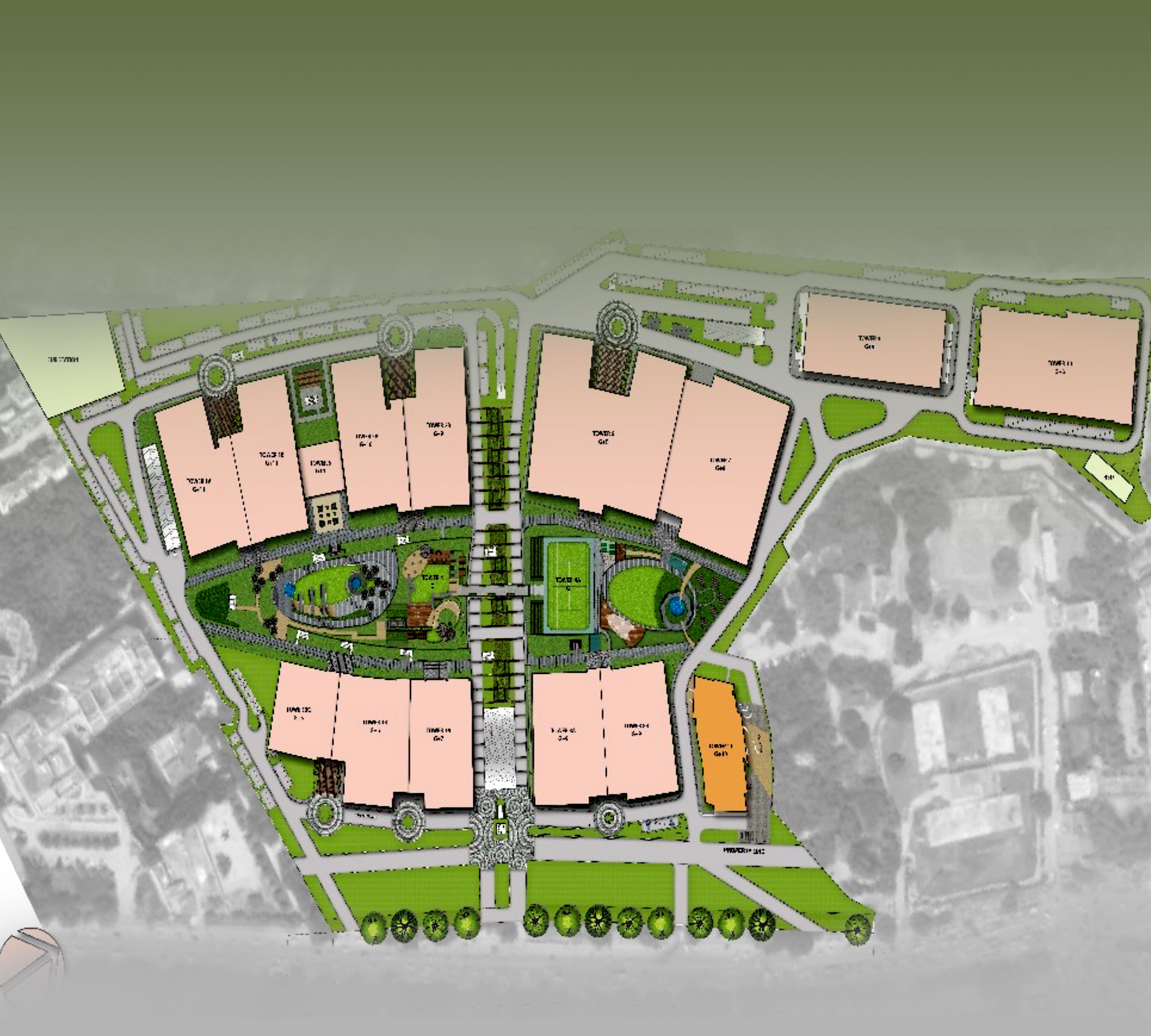
Client: Leading Facility/Service Management Firm
Location: Bangalore, Karnataka
Infrastructure Type: Commercial Campus
Provider: Clove Technologies Pvt. Ltd.
Project: Surveying and Digitization of Campus
Project Commenced: December 2018
Area: 15 Acres (Approx.)
Equipment Used: UAV & NavVis
Project Scope
Clove Technologies recently concluded a project summarizing smart usage of navigational applications that will provide for better visual perspective and space management of an entire campus facility.
The whole area to be captured and processed was approximately 15 Acres.
We Delivered -
- Capture & Acquire drone high-resolution imagery of proposed AoI covering the whole facility.
- Scan the Indoor environment using the NavVis smart trolley.
- Generate Processed ortho imagery with 3D View and Point of Interests that includes property attributes.
- Navigation in 3D Path.
- NavVis Indoor facility panoramic output with navigational walkthrough via web-based hosting.

Solutions

Clove offered innovative Spatially enabled Web Based ‘Data Centric’ solutions that reflects Reality ‘As Is’ using technologies such as:
- Surveying and Aerial (UAV) mapping for given interior and exterior of physical assets and surrounding environments of the facility.
- 3D and 3600 Immersive visual data within a comprehensive GIS database.
- Maps, building layouts, satellite images, photogrammetric mapping, GPS based ground survey inputs with desired and associated attributes.
Point of Interest Registration
Adding location intelligence to the basic street maps and shapefiles by extracting or adding Points of Interest (PoIs). Our Cartographic experts skillfully add geo-referenced Points and Features of Interest using various layered datasets and indicators to improve functional value of the maps. Our team creates dedicated geographic entities to each point, that supports several navigational and information applications such as digital mapping, augmented routing apparatus and private database validations.


Outdoor Navigation
Client was able to select a start and end destination points for navigational route for his desired experience.
We generated bespoke datasets to achieve street-level fully routable vector path network with turn-by-turn navigation specifications
Indoor Navigation
NAVVIS indoor scanner was used to perform the indoor scanning activity and created fully interactive digital twins of indoor spaces.
The Client was able access efficient routing through complex spaces and have visual tours of the inside facility.

Technology

Data Surveying Technologies that were used in the project included:
- Ebee UAV Drone
- Navvis Indoor Mapping Technology
Challenges
Our strategic predictions showed that it would be a challenge while flying the UAV equipment due to the massive area to be covered in a single day but was accomplished regardless of the complexities.
Applications & Key Take-Aways
- Access the map from anywhere.
- The customized map is optimized for mobile devices.
- Asset documentation of site conditions
- Geospatial Intelligence, the user-friendly GIS database enables the utility company to know the location and attributes of all in-field assets by seamless navigation with HD Pano imagery, 2D and 3D view.
- Data Analytics & Visualization
- Indoor As-built environment visualization.
