Nagpur Metro Raiilway Station Case Study
PROJECT SUMMARY
Client: A leading digital-geo solution provider and the lead bidder
Location: Nagpur, Maharashtra, India
Infrastructure Type: Rail and Transit
BIM and Data Acquisition : Clove Technologies Pvt. Ltd.
Project Commenced : December 2016
Project Finished : Schedule to finish by June 2018
Area : 55,400 Sq. M.
Software Used: UAV & NavVis
Going forward, all the future rapid transit systems are instructed to mandate the adoption of BIM practices. We were asked to produce georeferenced 3D BIM models for constructions listed below and an elevated bridge to enable better control of inventory
and avoid cost overruns.
Being designed to be the ‘Greenest Metro’, NMRCL decided to use the Design-Build-Operate methodology to control the usage of resources such as electricity, construction material, and manpower.
Opting to adopt BIM systems right from the design and construction level helped them to improve visualization, control costs, time, quality and safety for the Infrastructure improvement project.
Delivered detailed modeling of listed services at LOD 300, 350, and 400 using the CAD data given by the client. Though worked on various platforms to achieve fool-proof modeling, we made sure the delivered
files are sent in Dgn format with transmittals for the ease of construction engineers and installation professionals to access.

SCOPE OF WORK
Our Scope involved Architecture, Structure and MEP & FP services Modeling and Coordination with the Design Documents approved material submittals & Specifications Provided by the design consultant for the stations, Viaduct, Main Depot, including double-decker highway (Reach-1, 3 and 4) and OHE traction (WIP).
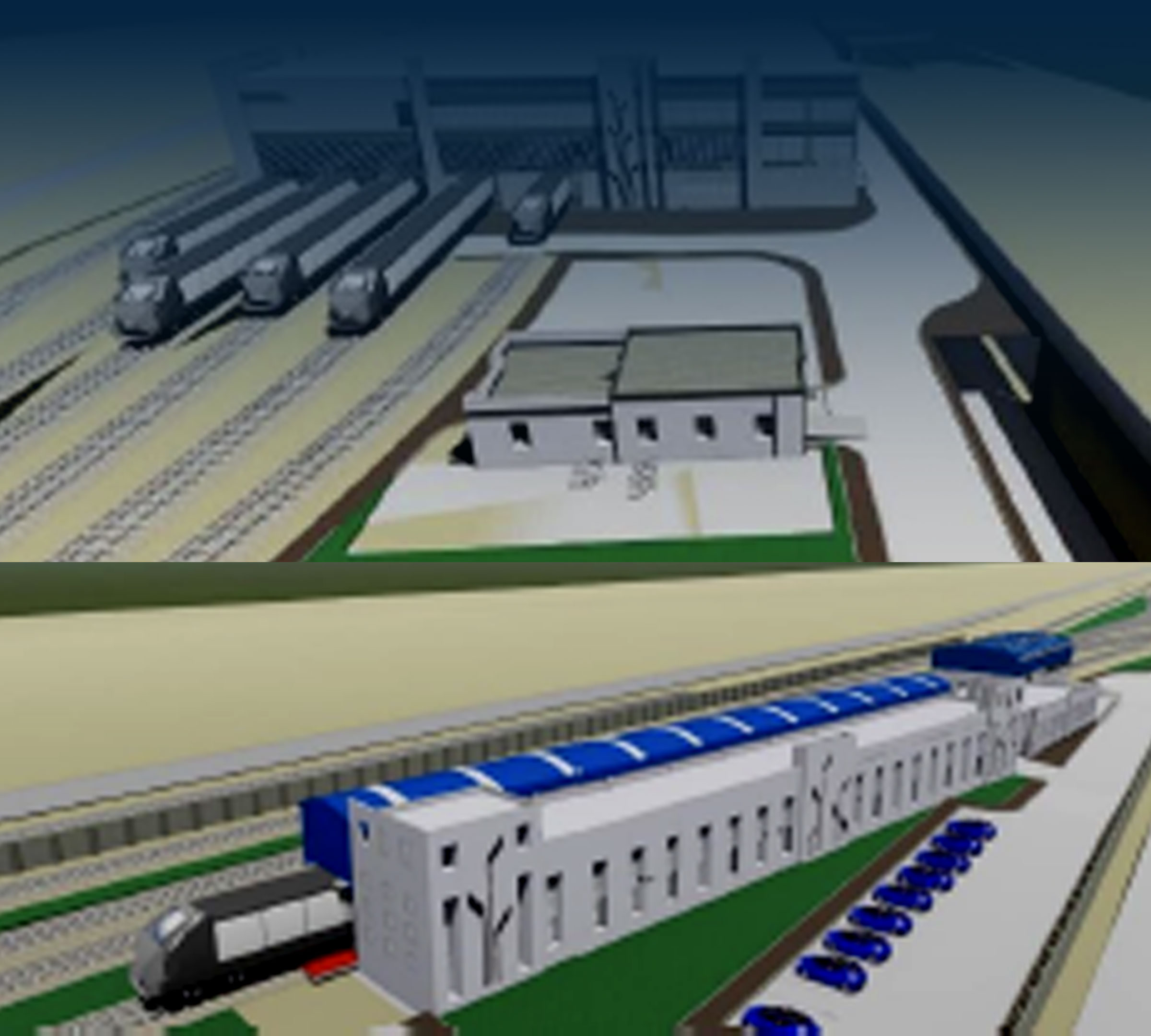
Metro Stations 9 Stations in Reach-1 and 7 Stations Reach-4 (work in progress)
Viaduct 7.63 KM in Reach-1 and 10.95 KM in Reach-3
OHE Traction (WIP) 5.8 KM of Priority Are
Main Depot 2 Depots from Reach-1 & 4

MAIN CHALLENGES AND RESOLUTIONS
Delay in data acquisition
Just like any massive venture that is first to implement BIM, we faced difficulties acquiring data from various sources. Most of the design architects, consultants, developers, and engineers are still following traditional methods to review, approve and
transfer design data files. Due to delay in data revisions from multiple teams, our models suf-fered from many clashes and de- sign conflicts, which resulted in unplanned setbacks.
We have followed the Common Data Environment (CDE) as implemented by the client (NMRCL) for file management system including naming convention, etc. But not all the design consultants have adopted this system
initially and using traditional tools and delivery systems made it very difficult to get the most up- dated/approved drawings to model in BIM. As soon as all the teams started adopting CDE central repository, the venture
turned more workable.
Last minute design changes
As the viaduct of the Metro Rail goes over a national highway, there is a double-decker track designed as per the initial design files. Due to lack of real-time communication, we struggled with multiple structural clashes with many pillars positions in
the design. It took a while to realize the reason is change of design from the architects isn’t reflecting in the created model.
Having a team of 20 GIS-BIM specialized personnel, we were able to rectify the situation and quickly re-model the whole section before the actual construction begun. This saved the stockholders from risking
wrong construction and spending respective material and resources on it.

Accelerating Engineering through 5D BIM implementation
Providing five-dimensional representation of the physical and functional characteristics of the project, empowered with cost-estimation software to visualize the progression of each construction phase and respective cost over time, whilst also providing
a 3D display platform for geovisualisation of large spatial scale data.
Our team at Clove Tech has successfully implemented 5D BIM for Pune-Metro that’s been certified by Bentley.We have done Implementation of CDE using ProjectWise, AssetWise & BIM-enabled Data Intelligent Multi-Dimensional
Models at LOD 400.
How did BIM Help?
- Involving platforms that acted as very powerful collaboration tools between various disciplines changed the approach of the teams towards the project as well as their perspectives. Creating common data environment helped to gather information from everywhere and have a repository.
- Using the vertical-specific software solutions, we were able to furnish multi-disciplinary teams with segment-specific models and analysis of networks, structures, stations, and tracks.
- The stockholders admitted that implementing the BIM practices in the project in- creased their productivity, reduced costs, improved safety, and eliminated hazards.
- The georeferenced BIM models we produced are not only to make construction easy but also can be processed and used during facility management since it involved Electronic Document Management System (EDMS) at modeling phases.
